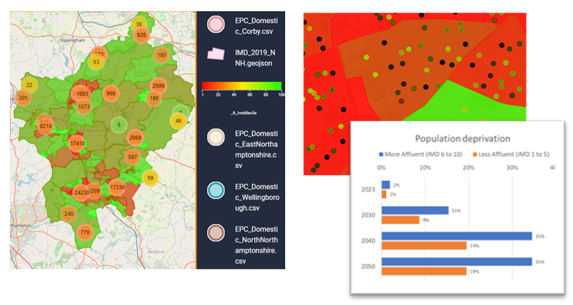

As part of the NN2NZ project we created a digital twin for North Northamptonshire local authority area in collaboration with Slingshot Simulations Ltd.
The platform provides a geospatial digital simulation of the 1,000km2 region and contains real world electricity network, social indicator, housing, transport and air quality data and allows simulation of the effects of low carbon initiatives at a regional level.
Objectives:
– Create a digital geospatial evidence base for the North Northamptonshire incorporating previously disconnected energy systems, buildings, land use, sociodemographic and mobility data sets.
– Incorporate carbon conversion factors for a diverse range of low carbon initiatives and technologies.
– Model the carbon saving impacts of sustainability initiatives and run simulations to rapidly optioneer low carbon interventions.
It provides a centralised platform that enables forecasting and impact analysis (energy, emissions, demographics affected) of potential interventions covering transport, buildings, energy systems and industry.
Analyses are run rapidly and can be easily iterated to provide geospatial insight to guide ‘on the ground’ deployment of initiatives to reach net zero.
– EV uptake impacts, use of alternative fuels, impacts of clean air zones, modal shift
– Targeting roll out of ASHPs and promoting the shift to renewables
– Impacts on deprived vs. affluent areas
– Energy savings per household, EPC improvements, access to infrastructure, CO2 impacts